The Vallon de l’Aiguebrun is a major geosite in the Luberon, renowned for its geomorphology, sedimentology, and tectonic history. It features a canyon bordered by cliffs, some reaching up to 100 meters in height, along with chaotic rock formations.
Location: Buoux
Site type: Remarkable geological formation,
Scenic viewpoint, Cultural site
Visit duration: 3 hours 30 minutes
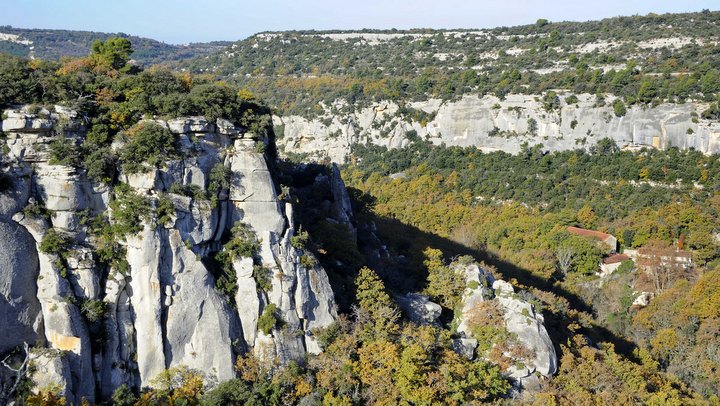

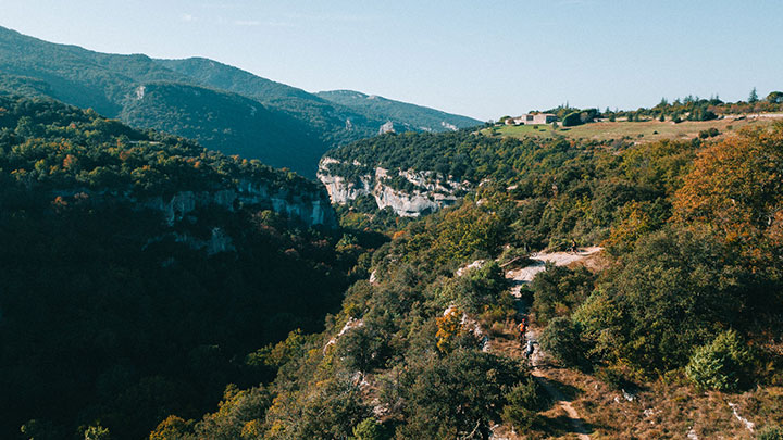
The Aiguebrun River has a unique course: originating in the northern Luberon, it flows through the massif from north to south before emptying into the Durance River. The river carves through the limestone massif, creating a narrow gorge known as the “Combe de Lourmarin.”
The Vallon de l’Aiguebrun is a “Messinian canyon,” formed from the drying up of the Mediterranean Sea over 5 million years ago, which led to the deepening of rivers and streams.
The Aiguebrun river cuts into the Claparèdes plateau, which is made up of marine deposits known locally as “Molasse” (a biodetrital rock composed of marine organism debris and small gravels). The rocky ledges often display beautiful oblique stratifications, indicating the presence of marine currents during the deposition of this molasse. Tectonically, the site provides a complete summary of the Luberon’s geological history.
Stages of the Formation of the Aiguille
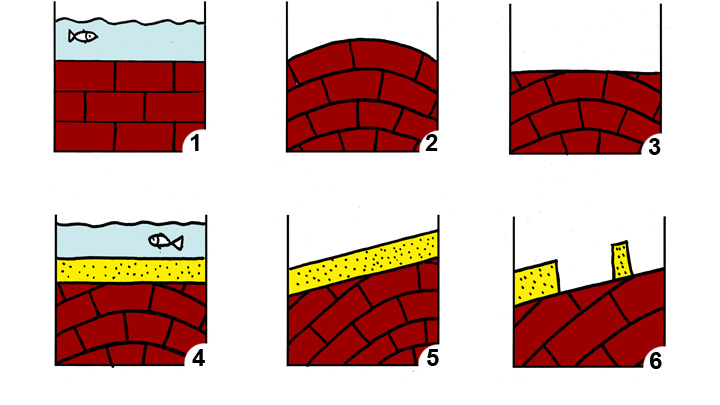
1 Deposition of Limestone in the Sea (around -130 million years ago)
2 Pyrenean-Provençal Folding (around -50 million years ago)
3 Erosion
4 New Deposition in the Sea (around -20 million years ago)
5 Alpine Folding
6 New Phase of Erosion in the Quaternary
Fort de Buoux
Perched on its rocky spur, the Fort de Buoux was long the keystone of the defensive system controlling communication throughout the Luberon.
Occupied since prehistoric times, it was fortified during the Middle Ages. Never captured, it housed a garrison and civilian populations until it was dismantled by order of Louis XIV around 1660. This was done to prevent it from permanently falling into the hands of the Protestants during the Wars of Religion.
PLUS D'INFOS
—
> Visitez le fort de Buoux [5]
DÉCOUVREZ-EN PLUS !
—
Préparez vos balades et randonnées avec
www.cheminsdesparcs.fr [6]
![]()
CONTACTEZ-NOUS
—
Accueil
Maison du Parc
60, place Jean Jaurès – 84400 Apt
> envoyer un mail [7]
> 04 90 04 42 00
Photo du bandeau : Molasse miocène © PNRL
— Vous aimerez aussi…
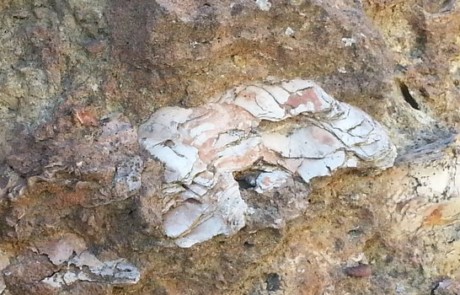
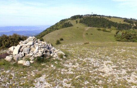

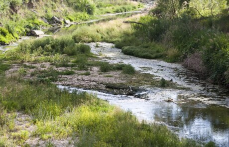


Photo du bandeau : © Prénom Nom